
October 20, 2014
Geography profs mapping crime and environmental impact
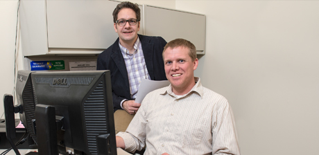
Andrew Miller and Rhett Mohler arrived at SVSU within a month of each other in fall 2012, when the duo brought a new push for initiatives using remote sensing and geospatial analysis.
Now, more than a year later, the two are overseeing two projects expected to shed light on trends ranging from crime to the environment.
 “It’s a skill that’s been needed in this area,” Miller said of the highly-detailed data mining that considers—among many elements —location and time. “What these projects do is give students theoretical and practical knowledge while organizing with groups to do something beneficial for the community.
”Miller is helping map violent trends in Saginaw while Mohler is investigating the environmental history of a swampy stretch of the northern Kawkawlin River. Both employ the help of students to collect and interpret the data. “There are so many applications for this kind of analysis,” Mohler said.
Miller is working with the Saginaw County Crime Prevention Council and the Saginaw Police Department to chart shootings and homicides from 2005 to 2013 in Saginaw, pegged by the FBI as one of the nation’s most violent cities of its size.
The geospatial data will help analysts consider information from a number of angles, and could reveal seasonal trends and conditions that suggest violence that is retaliatory in nature.
Miller said his students—Kevin Erb and Emily Gennrich—are still collecting data. When the task is finished and the information is analyzed, the students plan to present at the Association of American Geographers conference in Tampa, Fla.
Mohler’s student assistant, Nick Ross, will present findings on the Kawkawlin River study at the same event.
Mohler and Ross are working on the project as part of the Saginaw Bay Environmental Science Institute, a group featuring collaborating organizations and agencies including SVSU. Mohler said he hopes both contemporary and historical data point to whether the river stretch’s swampy conditions are caused by natural or human elements.
“We’re looking back as far as the 1840s and trying to pin down a date when this started,” he said. Mohler and his student in part will examine 19th century surveyor notes and aerial photography from as early as 1938 to determine causation.
Miller and Mohler credit each other for the development of the remote sensing and geospatial analysis push, an initiative that has involved networking with community groups and applying for financial support.
“What we have done has truly been a partnership,” Miller said. “We couldn’t have made these many in-roads with this many groups without each other.”